Open Source Products
~ we build & maintain ~
Built on
_blue_letters.png)
GeoPrism is an open-source toolkit that leverages semantic technologies for developing spatial decision support applications . It uses geo-ontologies to define the spatial semantic relationships modeled in a spatial knowledge graph and makes those knowledge graphs interoperable with Artificial Intelligence (AI) systems.


GeoPrism Kaleidoscope
(GeoAI)
®
GeoPrism Kaleidoscope is a solution for visualizing and exploring your geospatial data using AI. Bringing your data into AI using GeoPrism tools makes AI models more contextually relevant while unlocking the ability to get answers to questions in minutes that would have taken days or weeks in the past.
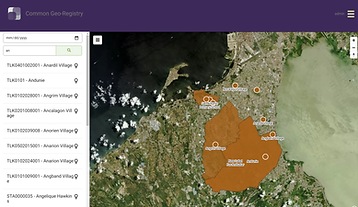
GeoPrism Registry
GeoPrism Registry is an IT solution that provides a single source of truth for managing geographic data over time across multiple information systems and data sources. It is used to publish, access, and manage changes over time to authoritative lists, associated hierarchies, and geospatial data for geographic objects such as administrative divisions, towns, infrastructure, and other relevant physical features.


GeoPrism Health Informatics
(GeoPrism HI)
GeoPrism HI fosters better collaboration by using geographic objects as the common link between health information systems and data on social determinants of health to improve patient care by facilitating interoperability and trend analysis.
Imagery Data Manager (IDM)
Developed by TerraFrame with its partner Zivaro for the US Department of Interior, the IDM is a cloud-based solution that cost-effectively stores, manages, processes, and shares imagery collected from unmanned aerial vehicles. It automates the ingest process, data delivery, and capture of the standard specifications for metadata and data formats. Large amounts of data can be reliably uploaded to the cloud with intermittent internet connectivity and poor bandwidth.
